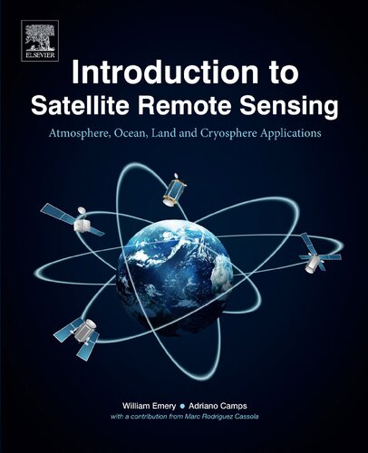
(Ebook PDF) Introduction to Satellite Remote Sensing Atmosphere, Ocean, Land and Cryosphere Applications 1st Edition by William Emery, Adriano Camps 0128092599 9780128092590 full chapters
$50.00 Original price was: $50.00.$25.00Current price is: $25.00.
Introduction to Satellite Remote Sensing Atmosphere, Ocean, Land and Cryosphere Applications 1st Edition by William Emery, Adriano Camps – Ebook PDF Instant Download/DeliveryISBN: 0128092599, 9780128092590
Full dowload Introduction to Satellite Remote Sensing Atmosphere, Ocean, Land and Cryosphere Applications 1st after payment.
Product details:
ISBN-10 : 0128092599
ISBN-13 : 9780128092590
Author: William Emery, Adriano Camps
Introduction to Satellite Remote Sensing: Atmosphere, Ocean and Land Applications is the first reference book to cover ocean applications, atmospheric applications, and land applications of remote sensing.
Applications of remote sensing data are finding increasing application in fields as diverse as wildlife ecology and coastal recreation management. The technology engages electromagnetic sensors to measure and monitor changes in the earth’s surface and atmosphere.
Introduction to Satellite Remote Sensing Atmosphere, Ocean, Land and Cryosphere Applications 1st Table of contents:
Chapter 1. The History of Satellite Remote Sensing
1.1. The Definition of Remote Sensing
1.2. The History of Satellite Remote Sensing
1.3. Study Questions
Chapter 2. Basic Electromagnetic Concepts and Applications to Optical Sensors
2.1. Maxwell’s Equations
2.2. The Basics of Electromagnetic Radiation
2.3. The Remote Sensing Process
2.4. The Character of Electromagnetic Waves
2.5. Electromagnetic Spectrum: Distribution of Radiant Energies
2.6. Atmospheric Transmission
2.7. Sensors to Measure Parameters of the Earth’s Surface
2.8. Incoming Solar Radiation
2.9. Infrared Emissions
2.10. Surface Reflectance: Land Targets
2.11. Study Questions
Chapter 3. Optical Imaging Systems
3.1. Physical Measurement Principles
3.2. Basic Optical Systems
3.3. Spectral Resolving Power; the Rayleigh Criterion
3.4. Detecting the Signal
3.5. Vignetting
3.6. Scan Geometries
3.7. Field of View
3.8. Optical Sensor Calibration
3.9. Light Detection and Ranging
3.10. Study Questions
Chapter 4. Microwave Radiometry
4.1. Basic Concepts on Microwave Radiometry
4.2. The Radiative Transfer Equation
4.3. Emission Behavior of Natural Surfaces
4.4. Understanding Microwave Radiometry Imagery
4.5. Applications of Microwave Radiometry
4.6. Sensors
4.7. Study Questions
Chapter 5. Radar
5.1. A Compact Introduction to Radar Theory
5.2. Radar Scattering
5.3. Radar Systems
5.4. Synthetic Aperture Radar
5.5. Synthetic Aperture Radar Interferometry
5.6. Future Synthetic Aperture Radar Systems
5.7. Radar Altimeters
5.8. Radar Scatterometry for Ocean Wind Vector Observations
5.9. Study Questions
Chapter 6. Remote Sensing Using Global Navigation Satellite System Signals of Opportunity
6.1. Brief Historical Review
6.2. Fundamentals of Global Navigation Satellite System Signals
6.3. Global Navigation Satellite System—Radio Occultations
6.4. Global Navigation Satellite System-Reflectrometry
6.5. Future Trends in GNSS-R
6.6. Study Questions
Chapter 7. Orbital Mechanics, Image Navigation, and Cartographic Projections
7.1. History
7.2. Kepler’s Laws of Planetary Motion
7.3. Map Projections, Image Navigation, and Georectification
7.4. Map Projections
7.5. Study Questions
Chapter 8. Atmosphere Applications
8.1. Cloud Remote Sensing
8.2. Atmospheric Aerosols and Optical Thickness
8.3. Atmospheric Profiling
8.4. Rain Rate, Atmospheric Liquid Water, and Cloud Liquid Water
8.5. Study Questions
Chapter 9. Ocean Applications
9.1. Sea Surface Temperature
9.2. Sea Surface Height and Satellite Altimetry
9.3. Synthetic Aperture Radar Ocean Applications
9.4. Ocean Wind Scatterometry
9.5. Conclusions
9.6. Study Questions
Chapter 10. Land Applications
10.1. Historical Development
10.2. Landsat Applications
10.3. Land Cover Mapping
10.4. Commercial High-Resolution Optical Imagery
10.5. Forest Fire Detection and Mapping
10.6. Measuring and Monitoring Vegetation From Space
10.7. The European Copernicus Program
10.8. Study Questions
Chapter 11. Cryosphere Applications
11.1. Introduction
11.2. Polar Observations
11.3. Sea Ice
11.4. Ice Sheets
11.5. CryoSat Instruments
11.6. Using Scatterometry to Compute Sea Ice Concentration and Drift
11.7. Thin Ice Thickness Estimation
11.8. Multiyear Arctic Sea Ice Classification Using OSCAT and QuikSCAT
11.9. Arctic Sea Ice Drift Estimation by Merging Radiometer and Scatterometer Data
11.10. Merging the Sea Ice Drift Products
11.11. Study Questions
Chapter 12. Remote Sensing With Small Satellites
12.1. Introduction
12.2. Earth Observation Using Constellations of Small Satellites
12.3. Future Trends in Small Satellites
People also search for Introduction to Satellite Remote Sensing Atmosphere, Ocean, Land and Cryosphere Applications 1st:
an example of remote sensing
intro to satellite communications
first remote sensing satellite of world
first remote sensing satellite was launched on
what is remote sensing satellite
You may also like…
Computers - Programming
Biology and other natural sciences - Ecology
Astronomy - The Solar System - Astronomical Studies & Observations
Engineering
Advanced remote sensing terrestrial information extraction and applications Second Edition Liang


